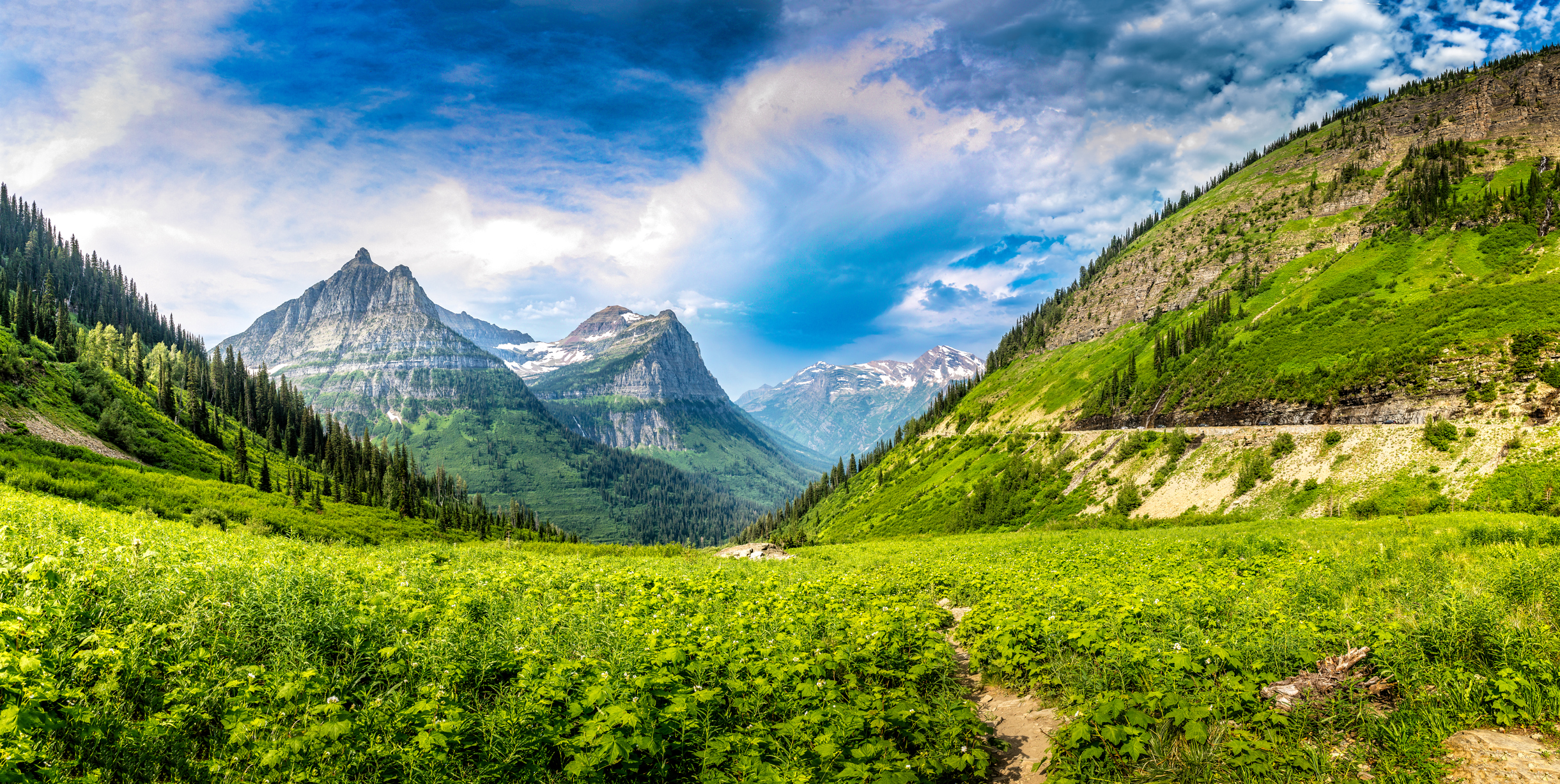
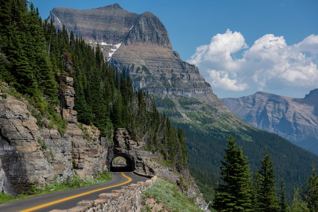
Montana's Glacier National Park is known as the "Crown of the Continent" and is one of America's most spectacular national parks. It's a hiker's paradise, with over 700 miles of trails that include steep passes, alpine lakes and meadows. Hiking areas are classified into the west side around Lake McDonald and the east side, which includes Many Glacier, St. Mary and Two Medicine. The Going-to-the-Sun Road also has many hiking trails that offer beautiful scenery and opportunities to view wildlife. The following 10 hikes are the best Glacier National Park has to offer in 2022.
Highline Trail
Area: Going-to-the-Sun Road
Trailhead: Logan Pass
Distance: 11.8 miles
Difficulty: hard
Elevation change: 690 feet gain
Many hikers consider the Highline Trail to be the best hike in Glacier National Park. The end-to-end distance is 11.8 miles, and you can catch a shuttle bus back to your starting point at the Logan Pass visitor center. The distance to Granite Park Chalet and back is 15.4 miles. This trail requires a full day, a high degree of physical fitness and no fear of heights. The high elevation of the Highline Trail provides many spectacular mountain views, including Bear Valley, Garden Wall and Haystack Saddle. Sections of this steep trail remain covered in snow until early July, which is when this trail usually opens.
Grinnell Lake Trail
Area: East Side
Trailhead: Many Glacier Hotel
Distance: 6.8 miles
Difficulty: easy to moderate
Elevation change: 40 feet gain
The Grinnell Lake Trail includes part of the Swiftcurrent Nature Trail, but takes you deeper into the wilderness. Beginning from the Many Glacier Hotel, you'll cross a small hill behind Swiftcurrent Lake and follow Josephine Lake's north shore to the boat dock at its far end. From there, you'll take the Grinnell Lake Trail to Grinnell Lake. The round trip is 6.8 miles, but you can also take a tour boat back. However, those with reservations have priority. This area has an abundance of food sources for grizzly bears, making sightings quite frequent. Making noise and carrying bear spray are essential safety measures when hiking this trail.
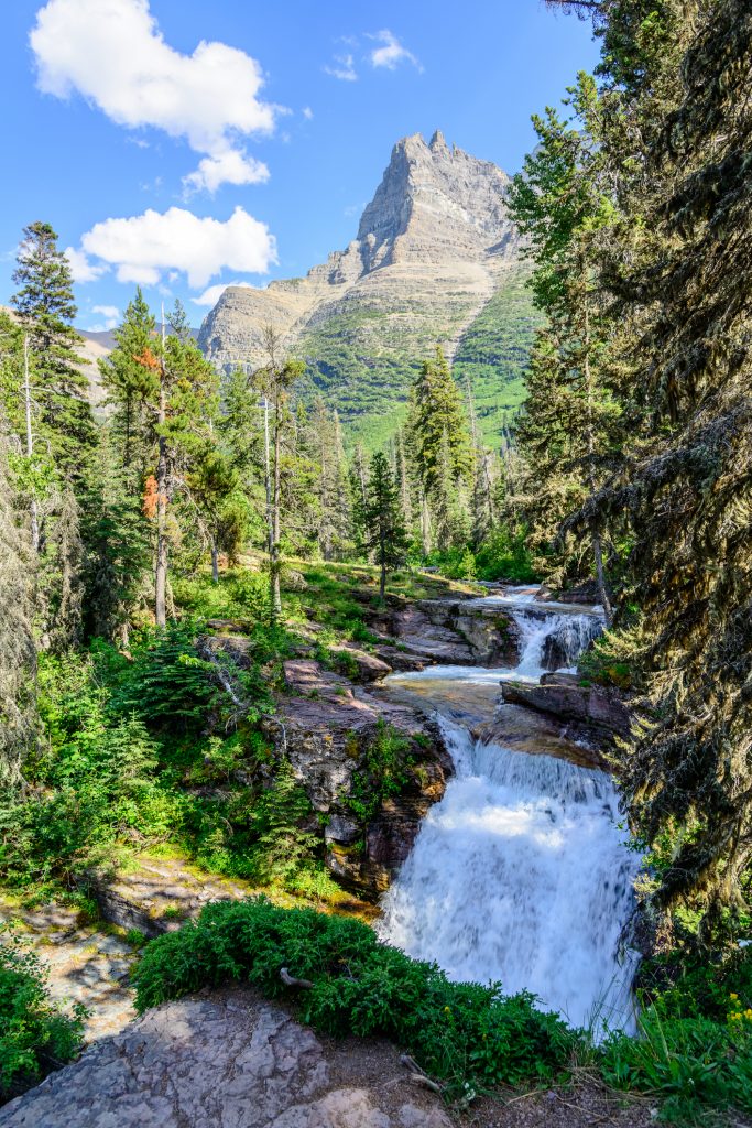
St. Mary and Virginia Falls Trail
Area: Going-to-the-Sun Road and East Side
Trailhead: St. Mary Falls Shuttle Stop
Distance: 3.2 miles
Difficulty: moderate
Elevation change: 260 foot loss
The St. Mary and Virginia Falls Trail is one of the few in Glacier National Park that leads to a waterfall. The most direct route begins at the St. Mary Falls shuttle stop and ends at St. Mary Falls, which is 3.2 miles for the round trip. Additional starting points for this trail include the trailhead for the Going-to-the-Sun Road, Sunrift Gorge and Sun Point, which significantly increases the distance for the round trip. The temperature at the falls is noticeably cooler than the surrounding area, making it a popular picnic area during the summer.
Redrock Falls Trail
Area: East Side
Trailhead: Swiftcurrent Motor Inn
Distance: 3.6 miles
Difficulty: Easy
Elevation change: 100 feet gain
The Redrock Falls Trail begins at the Swiftcurrent Motor Inn and leads into the forest down to Fishercap Lake, which is frequented by moose. It continues along the shore and follows a creek that flows into Redrock Lake, which has Redrock Falls at the end. This area is a nice picnic spot and especially popular among children. However, the hills surrounding the top of the hills have common bear sightings.
Trail of the Cedars
Area: Going-to-the-Sun Road, West Side
Trailhead: Avalanche Picnic Area
Distance: 0.7 miles
Difficulty: Easy
Elevation change: insignificant
The Trail of the Cedars is one of the most popular of the easy hikes in Glacier National Park. It begins at the Avalanche Picnic Area, which is always very busy during the summer. This trail is primarily a boardwalk that takes you on a stroll through a rain forest like those in the Pacific Northwest. Some of the red cedars in this forest are over 500 years old, with other trees that include hemlocks and black cottonwoods. The elevation change is negligible, making it wheelchair accessible.
Hidden Lake Overlook Trail
Area: Going-to-the-Sun Road
Trailhead: Logan Pass
Distance: 2.8 miles
Difficulty: Moderate
Elevation change: 460 feet gain
The Hidden Lake Overlook Trail is a highly popular hike that often remains partially covered by snow until July. It's usually crowded, so you should do it shortly after sunrise or before sunset. The trail begins behind the Logan Pass Visit and remains a boardwalk for the first half of the hike. It then climbs to the Hidden Lake Overlook, which provides a panoramic view of Logan Pass, with the cliffs of Clements Mountain to the right.

Siyeh Pass Trail
Area: Going-to-the-Sun Road
Trailhead: Siyeh Bend
Distance: 9.2 miles
Difficulty: Hard
Elevation gain: 2,240 feet
The Siyeh Pass Trail provides one of the best views of the park's glaciers. Beginning at Siyeh Bend, this trail climbs through alpine woods, arriving at a wildflower-filled meadow after about 2 miles. A series of switchbacks will take you above the tree line to Siyeh Pass. Another series will take you over the pass, before descending into Sunrift Gorge along the Going-to-the-Sun Road.
Avalanche Lake Trail
Area: Going-to-the-Sun Road, West Side
Trailhead: Avalanche Picnic Area
Distance: 4.6 miles
Difficulty: Moderate
Elevation change: 500 feet gain
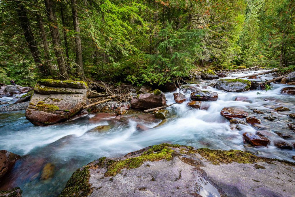
The Avalanche Lake Trail is the most popular moderate hike on the west side of Glacier National Park. It starts at the Avalanche Picnic Area, which is halfway around the Trail of the Cedars. The trail rises steeply for a short distance at this point before going into thick woods that allow you to see glacier-carved cliffs above you on your left. It ends at Avalanche Lake, which is surrounded by sheer cliffs and waterfalls.
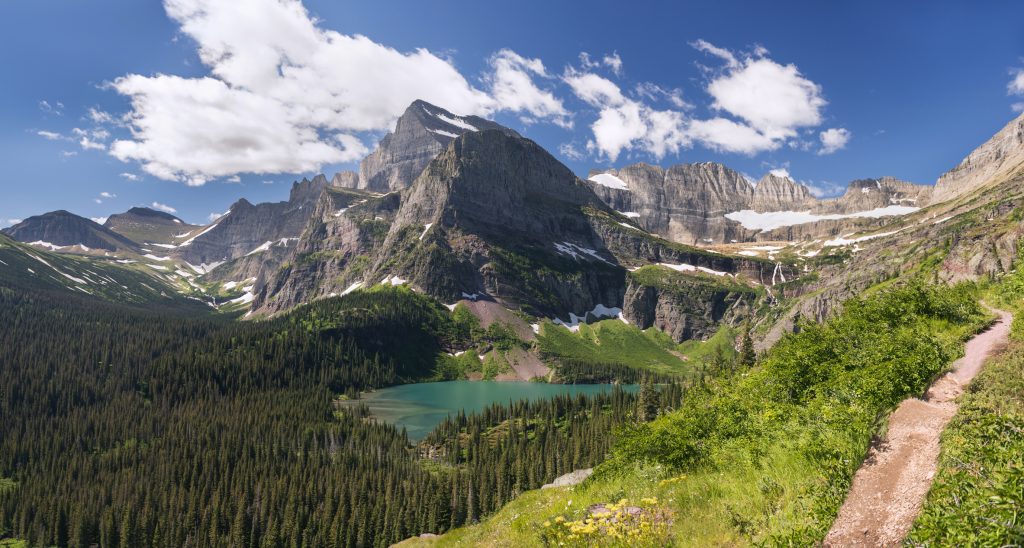
Grinnell Glacier Trail
Area: East Side
Trailhead: Swiftcurrent Picnic Area
Distance: 10.6 miles
Difficulty: Hard
Elevation change: 1,600 feet gain
The Grinnell Glacier Trail is a favorite of many hikers because it leads to the park's only glacier that's accessible by a hiking trail. It starts at the Swiftcurrent Picnic Area and leads along the north shore of Swiftcurrent Lake and Lake Josephine. Once you reach the midway point of Lake Josephine, you'll split off away from the lake and climb well above the tree line.
Iceberg Lake Trail 161
Area: East Side
Trailhead: Swiftcurrent Motor Inn
Distance: 9.6 miles
Difficulty: hard
Elevation change: 1,200 feet
The Iceberg Lake Trail is a must-do during the summer, when the lake is accessible but still has icebergs floating in it. Beginning behind the Swiftcurrent Motor Inn, this trail climbs steadily through woods and meadows of wildflowers. After about 2.5 miles, you'll reach Ptarmigan Falls, which is a great spot for a break. Iceberg Lake is another 2.3 miles further up the trail.
The trails in Glacier National Park range from lakeshore strolls to epic backpacking trips. It's one of America's busiest national parks in America, but it's still a very wild place. Cell service is extremely limited in Glacier National Park, so a rescue could take hours or even days, depending on the trail. Always stop by a ranger station or visitor center to get current information on trails, weather and wildlife.